The 1974 Mason, Ohio tornado
7/31/26
I have always been interested in the tornado that struck our house in Mason, Ohio during the Wednesday, 3 April 1974 superoutbreak. I was 11 at the time, and my brother Mark was 12, so the storm left a strong impression. I still have tornado dreams. I’ve been tracking down the details of the storm.
Sleuthing a photograph
A photo on Wikipedia rekindled my interest because it had the caption “The tornado as it approached Sayler Park in Cincinnati, Ohio”. Here is a copy of the photo:

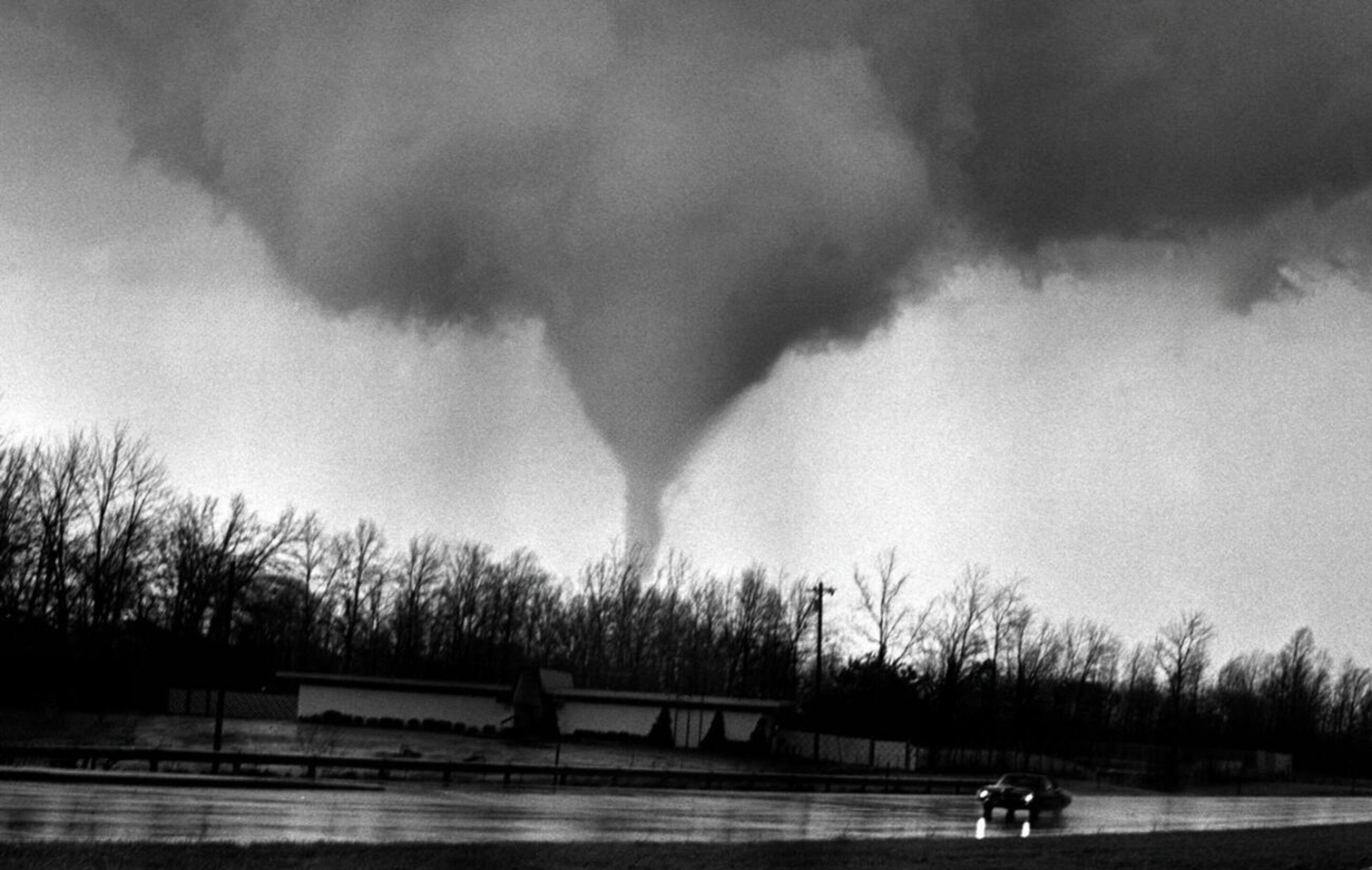
I remember the building in the foreground because I rode by it every day to high school and college, and it is nowhere near Sayler Park, which is west of Cincinnati along the Ohio River. This building, a country club, was on the west side of I-71, just north of the Pfeiffer Road exit near Montgomery, Ohio. This set me on a quest to find definitive evidence.
After some searching, I found it on Alamy stock photos, along with several others in the series. Their photo caption (“provided by our contributors”) says:
Apr 03, 1974 - Cincinnati, Ohio, USA - Formation of a tornado funnel in the northeast suburbs of Cincinnati, Ohio April 3, 1974, that was photographed, looking north from Interstate 71 at the Pfeiffer Road interchange, in the Blue Ash-Montgomery area. This tornado was one of 148 tornados to strike in 13 central US states in an 18 hour period. The 'Super Outbreak' is the most extensive tornado outbreak on record and damaged 900 square miles along a total combined path length of 2,600 miles killing more than 300 persons. (Credit Image: © Ken Stewart/ZUMA Press)
With more searching, I discovered that the Wilmington, Ohio office of the National Weather Service has a page on the 3 April 1974 superoutbreak, and on it, they show the front page of the Cincinnati Post with the same picture. Even better, I discovered that I had the same newspaper in my scrapbook files:
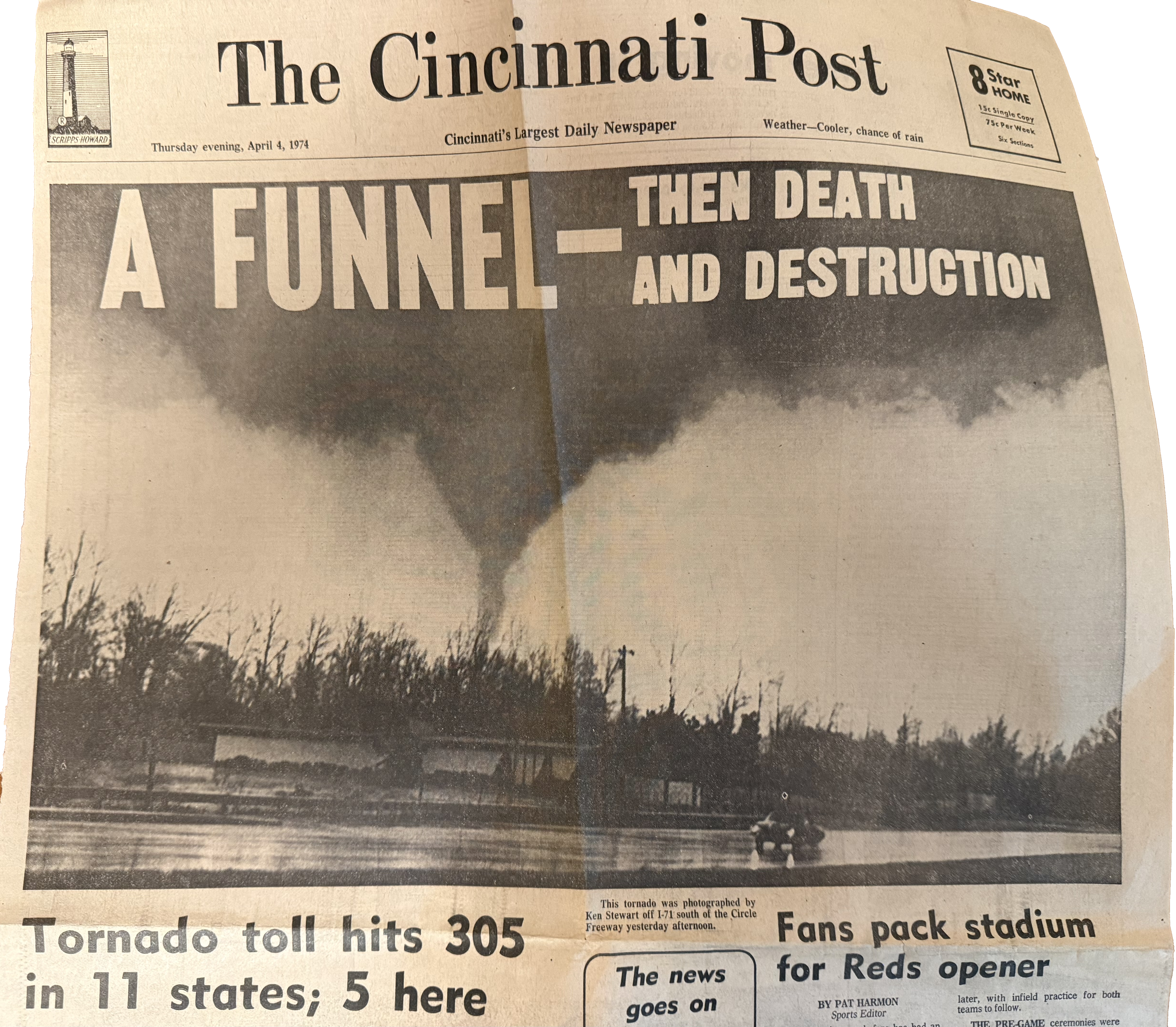
The image is credited to Ken Stewart, and the caption says it was taken along I-71 south of the circle freeway (I-275), consistent with it being from Pfeiffer Road, not Sayler Park.
What is more interesting are the other photos from Ken Stewart, purchased through Alamy. I’ve put these in chronological order by tracking the tornado’s northward (rightward) movement relative to the building, the telephone pole, and the trees.
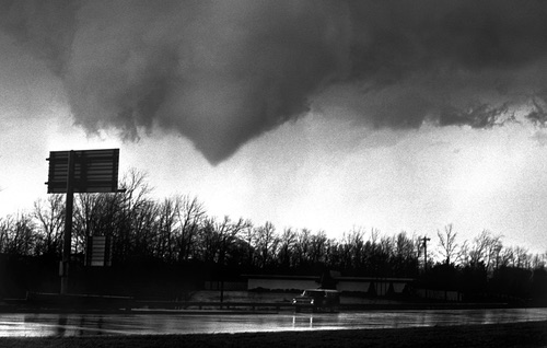
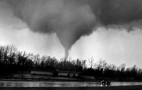
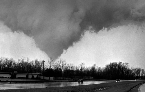
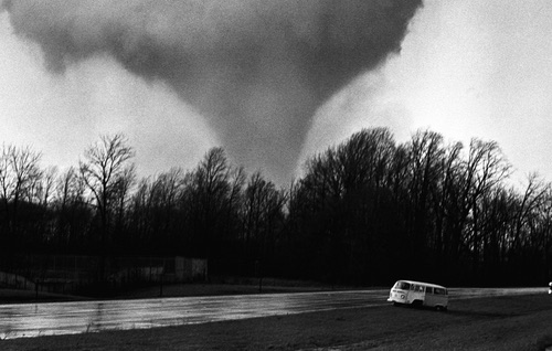
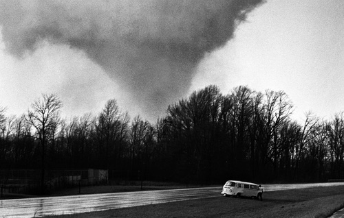
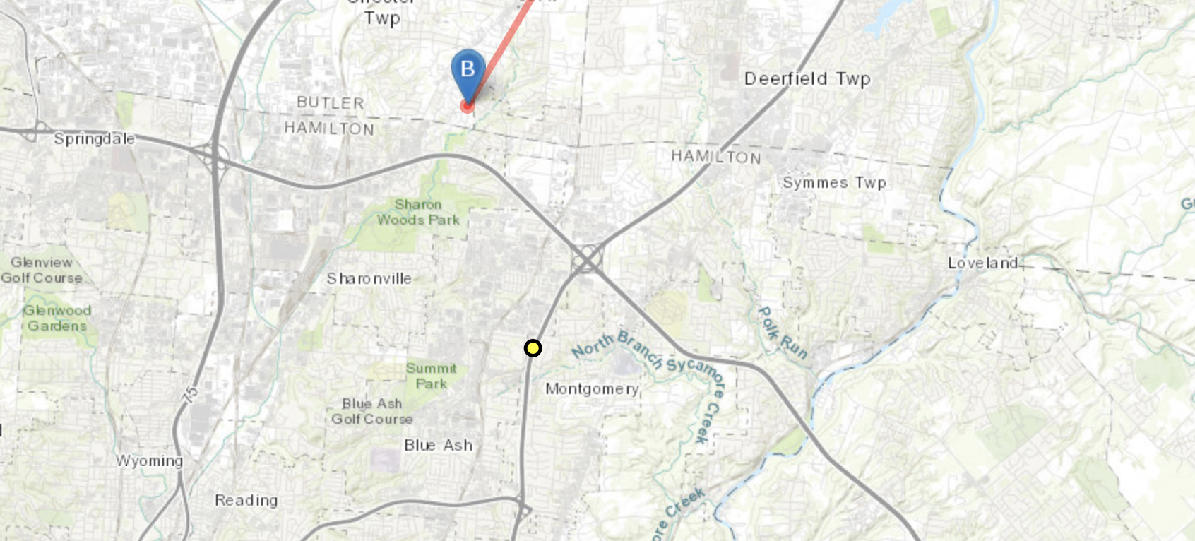
These five photos show the funnel cloud above ground, touching down, and quickly growing as it moves northward. Based on the country club and the angle of the shot, the tornado would have been to the north-northwest and not far away. This matches the map at NOAA’s National Environmental Information Center, which shows the tornado touching down (blue B pin) just north of Fields–Ertel Road, a little north of Sharon Woods Park. The yellow dot is the country club. That puts the tornado about 3 miles north-northwest of where Ken Stewart took this amazing sequence of photos.
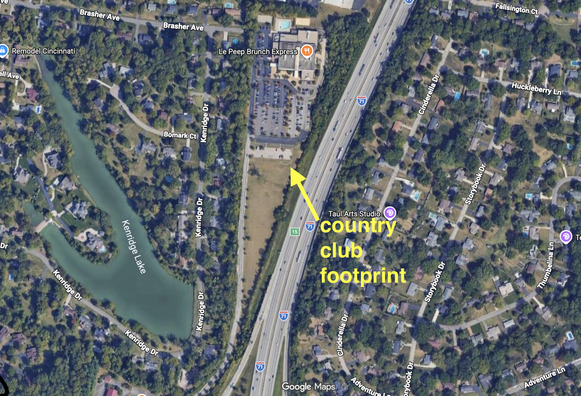
Although the country club has since been torn down, the concrete slab foundation remains. The ramps for the Pfeiffer Road exit are visible at the bottom of the photo.
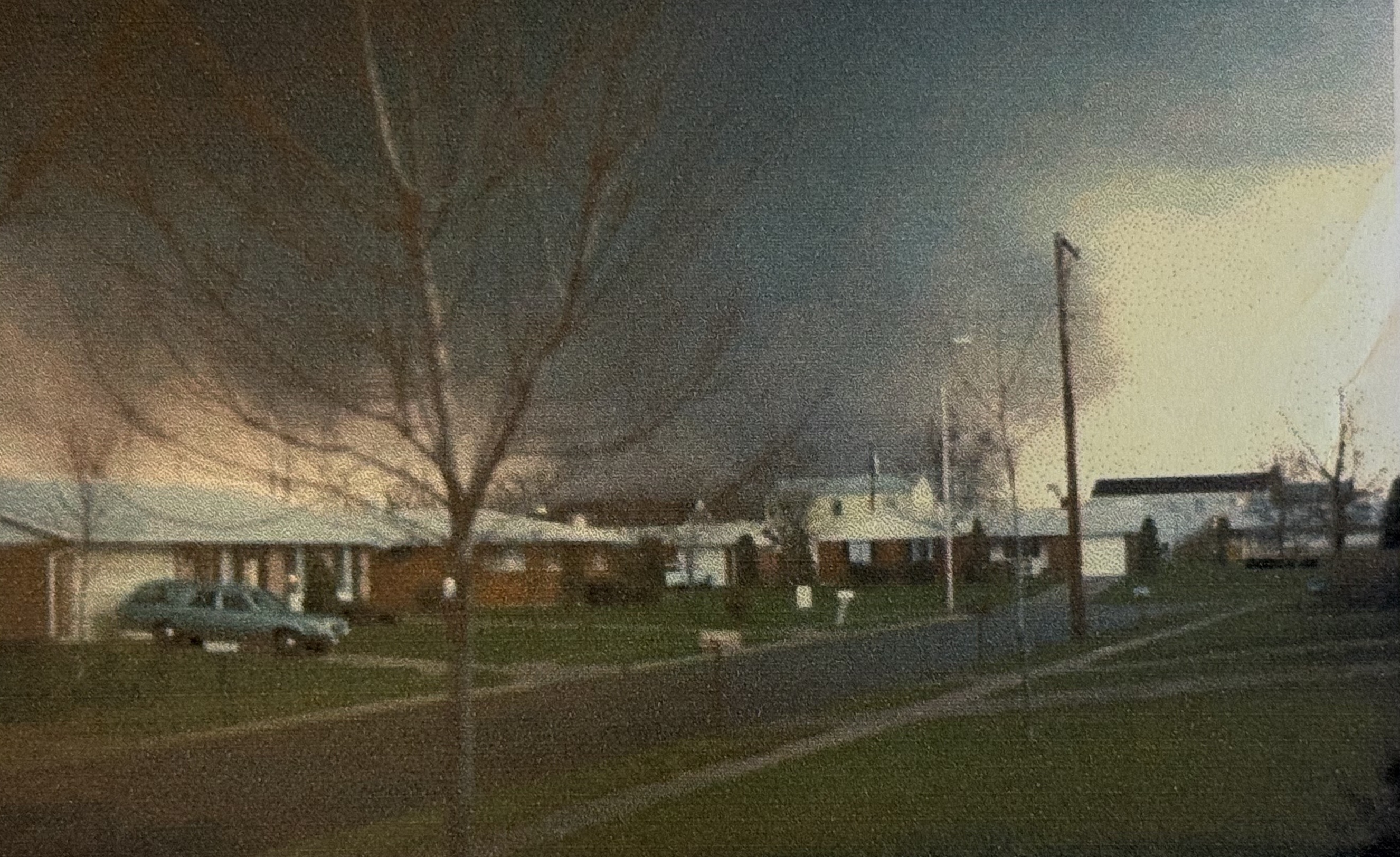
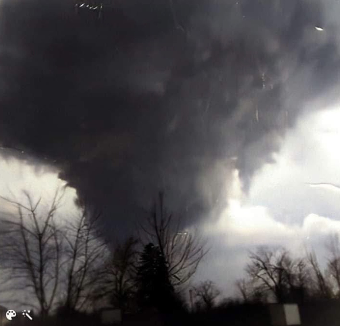
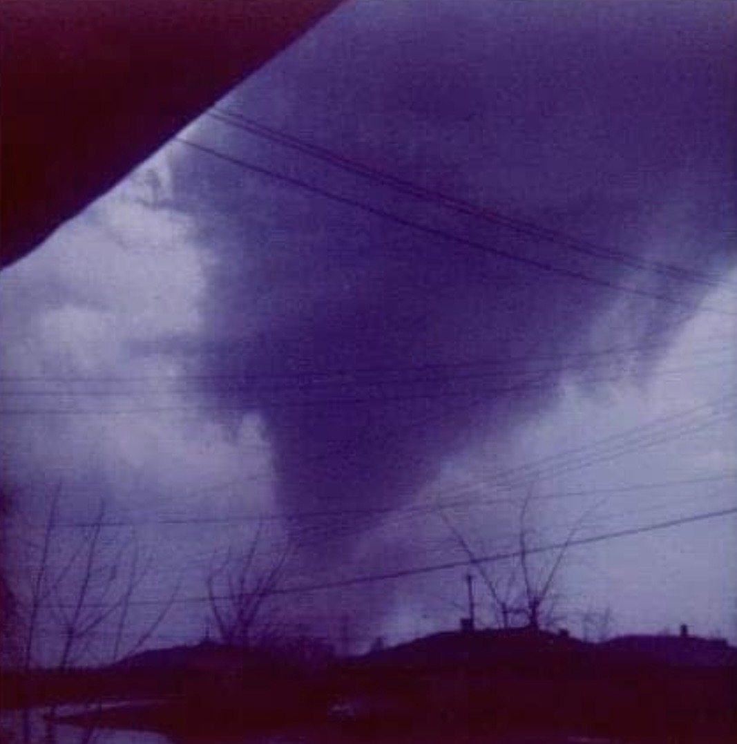
I’ve come across three images claiming to be from the Mason tornado, but the sources were not stated. It’s hard to know if these are from Mason or just some other tornado. None stated exactly where the picture was taken or what direction they were facing.
The track of the tornado
Using the tornado’s endpoints from the National Environmental Information Center, plus locations I know were hit by the storm, I put together a rough map of its track. Downtown Mason is at the firehouse, and our house was across the street from the church. In 1974, there were far fewer houses and streets than shown in this modern satellite view, and most of the area around Mason was farmland.
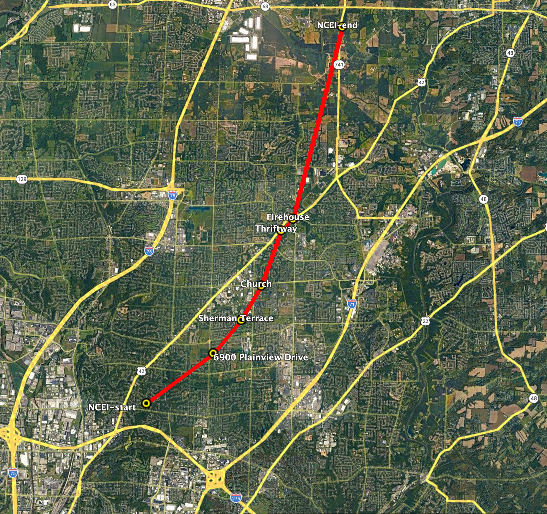
The path of the tornado curves to the left, as Dr. Ted Fujita found was true for most tornadoes during the superoutbreak. Dr. Fujita was a University of Chicago meteorologist and originator of the F scale for measuring tornado strength, now called the EF scale. By coincidence, I would later see Dr. Fujita frequently when I was a graduate student in the Department of Geophysical Sciences at the University of Chicago, although he worked on a different floor than us paleontologists.
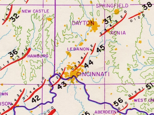
On Dr. Fujita’s map, shown above, the Mason tornado is #44. The small numbers to the side of each tornado path indicate the tornado intensity on the Fujita scale, ranging from F0 (the weakest) to F5 (the strongest). The Mason tornado reached a rating of F4 close to where we lived, quite strong, but not as strong as the exceptionally devastating and deadly Xenia storm (#37). Dr. Fujita discovered that single northeastward-moving storm cells repeatedly generated tornadoes, such as the 40–45 series (40 and 41 are not shown on this map). You could say that the Sayler Park (#43), Mason (#44), and Lebanon (#45) tornadoes were sibling storms.
Storm damage
The superoutbreak affected such a large area that it is easy to find photographs of tornadoes and their damage; it is harder to find images from the Mason tornado specifically.
Working along the path of the storm, the first images I came across are a series from Plainview Drive and Butler–Warren Road, posted by 3 Moon Photo. The twenty-some photos on their site show significant damage to houses and trees.
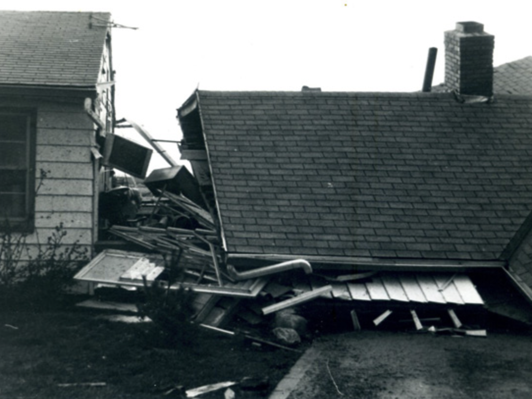
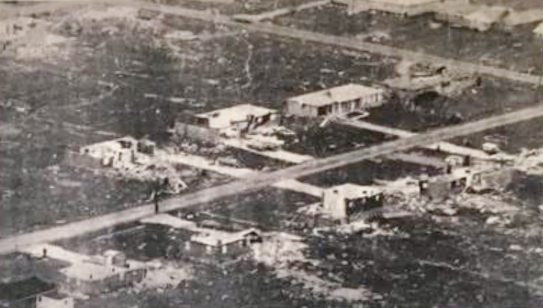
About a mile (1.7 km) to the northeast, the Sherman Terrace neighborhood was hit hard, with many houses destroyed.
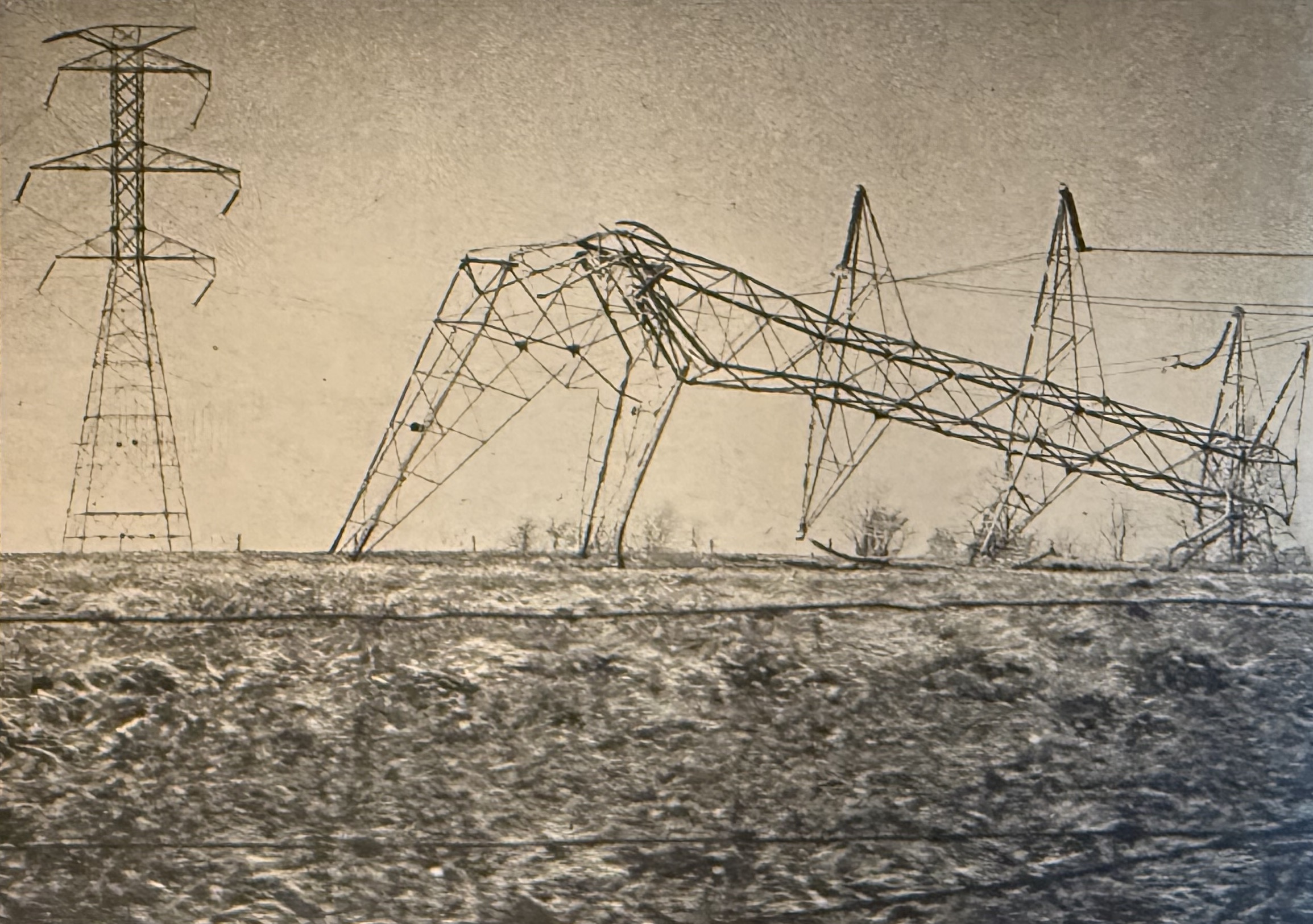
Half a mile (900 m) to the north, the high-voltage overhead power lines that ran east–west along the ridge south of Western Row Elementary School were twisted and flattened. I remember this was a stunning sight at the time, to see how easily these were crumpled. Many were without power for days because of these downed lines.
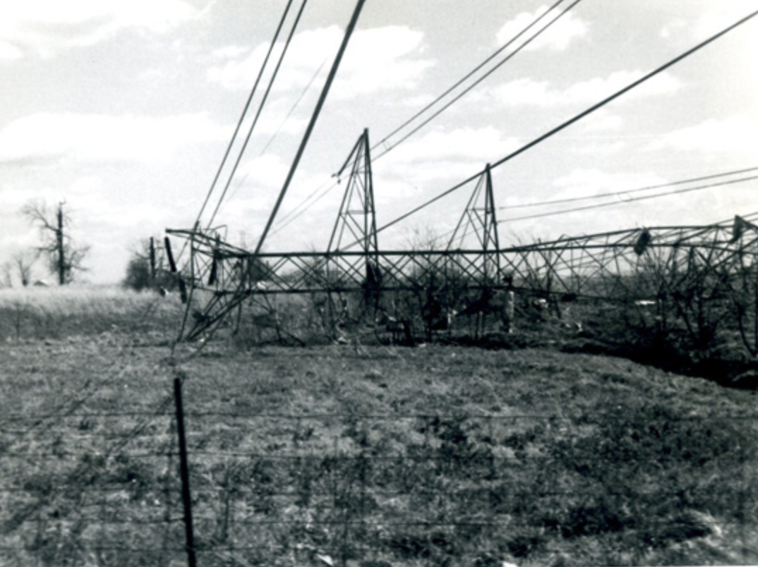
A few weeks later (19 May), the Cincinnati Enquirer did an entire issue of their Sunday magazine on the tornadoes. In it, they included this visceral photograph of these power lines.
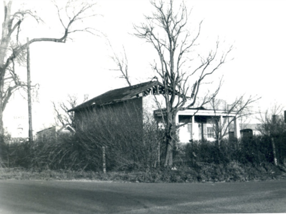
A third of a mile (600 m) farther north, the one-room schoolhouse (then just a home) at the corner of Western Row Road and Snider Road was damaged. The house was torn down shortly after the tornado.
About 700' (200 m) to the east of the schoolhouse was the Mason Church of Christ, whose sanctuary was flattened by the tornado. Ironically, our neighbors were concerned for their safety because they lived in a poorly constructed prefabricated house, so they sought shelter in the church. Fortunately, they made it through with only cuts, but I remember them being deeply shaken. In this photo, the sanctuary is on the left, with the damaged but still standing business offices on the right. Our house was beyond this photo, just to the left of the frame.
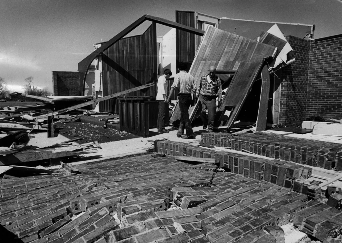
The church was rebuilt in a much larger structure just to the east of its original site, and the former church business offices became a Masonic Lodge. Nothing was ever built over the site of the old sanctuary, and it remains a parking lot.
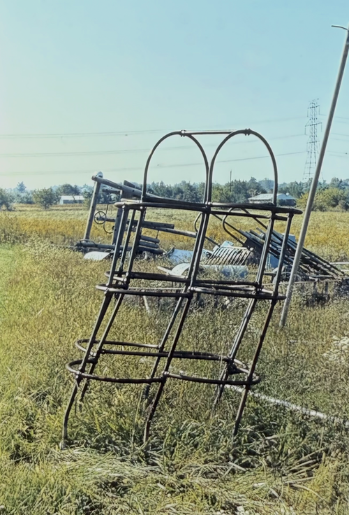
Just behind the church was the playground for Western Row Elementary School, and it had a 6' (2 m) jungle gym made of thick tubular steel, which was bent by the tornado as if someone had backed a truck into it. The school left it in place for years, but unbolted it and other playground items for a remodel in 1986. Here’s a photo of it; the items in the background are from the remodel, not storm damage. This view faces south and the restored power lines are visible in the background. That tower was one of the ones that was mangled by the tornado, and beyond it is the Sherman Terrace neighborhood.
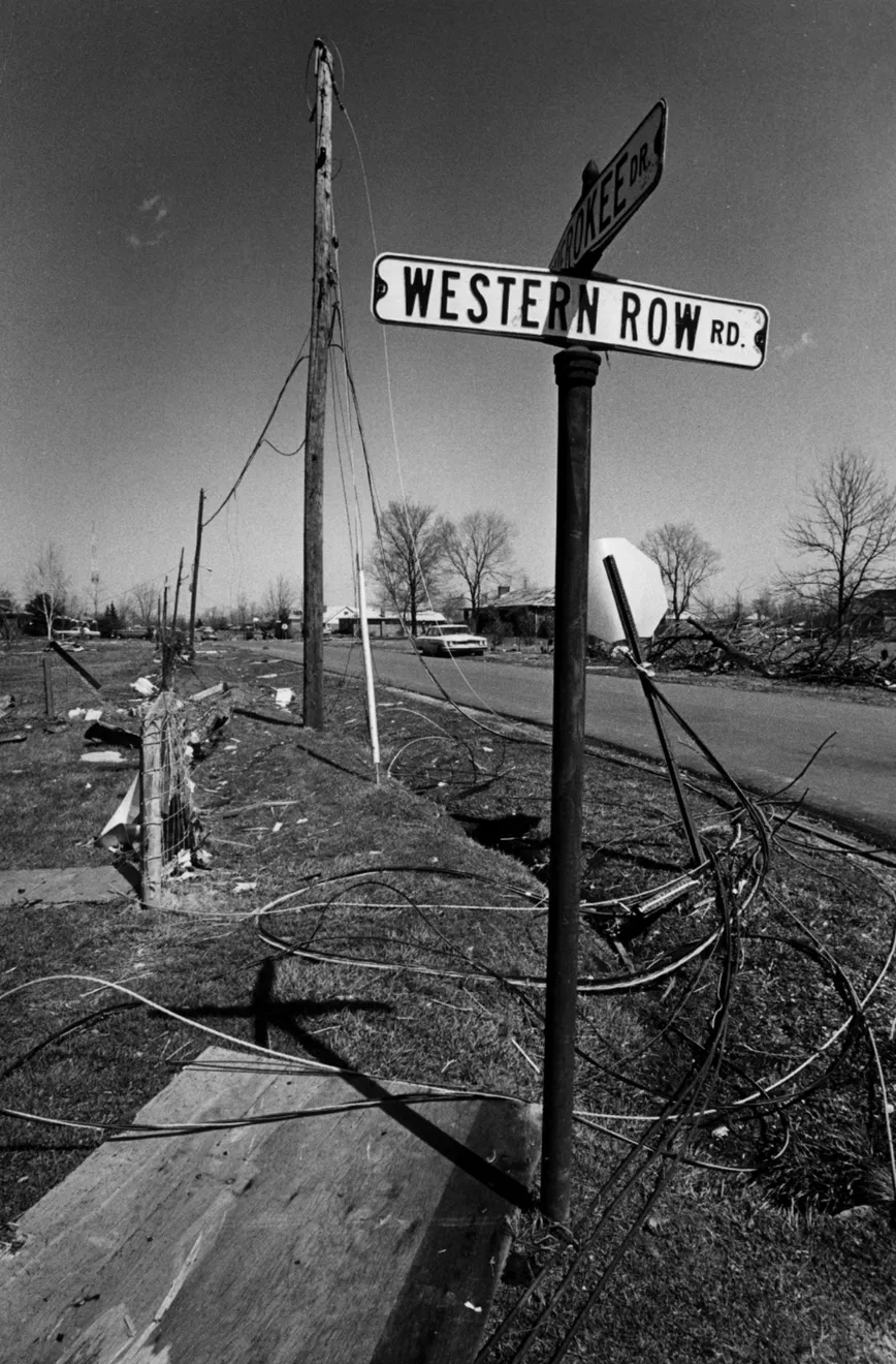
About 450' (140 m) east of the church is the intersection of Western Row Road and Cherokee Drive, showing the downed power lines. This view faces north down Cherokee Drive. Many houses along Cherokee Drive and adjacent residential streets were badly damaged. I remember one garage leaning jauntily away from the house to which it was supposed to be attached. At the far end of the street is the WLW radio tower, something I’ll return to.
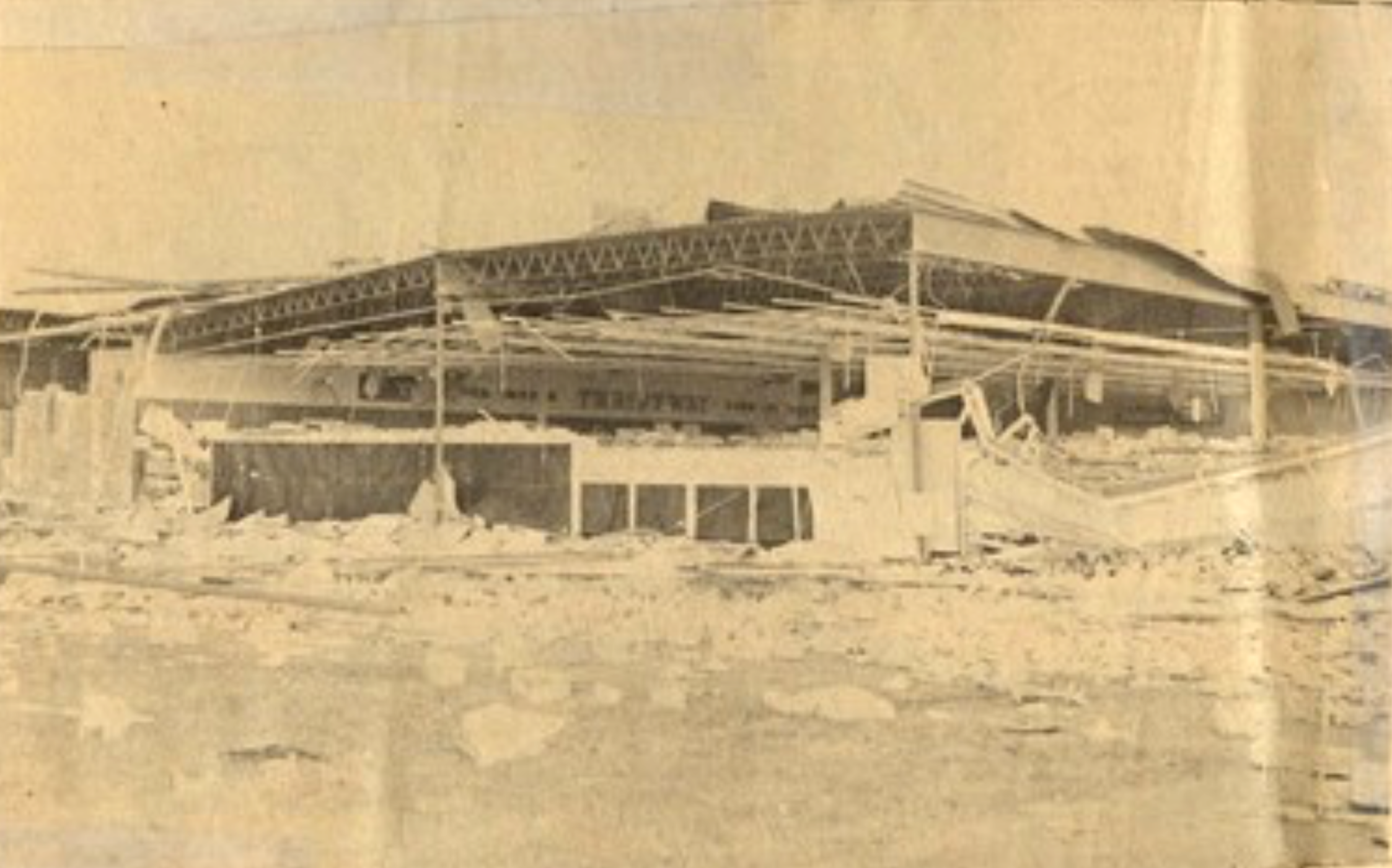
About 1.3 miles (2 km) north of the church, the better grocery store in town (Thriftway) was heavily damaged by the tornado. So much of the front of the store was destroyed that the Thriftway sign hanging on the store’s back wall is visible in this photograph from the Mason West-Chester Pulse.
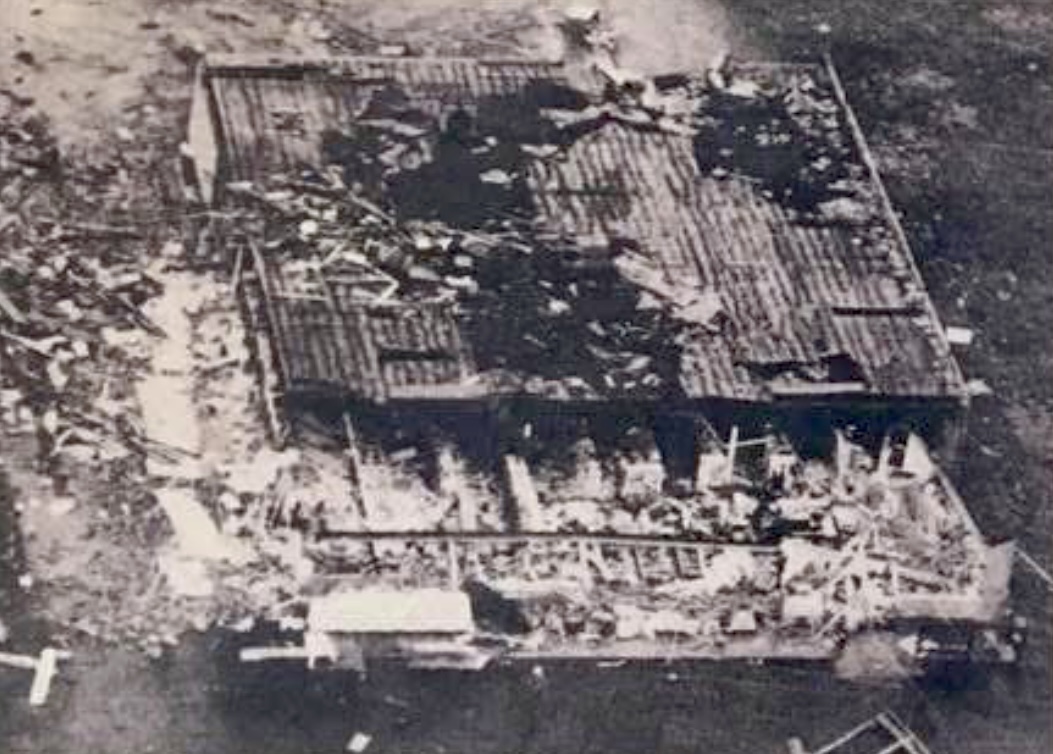
This aerial view shows the extent of the damage: the front one-third of the roof is completely gone, and large portions of the rest of the roof are highly damaged. The building was unsalvageable and was demolished shortly after the tornado.
The store manager averted disaster by shepherding the customers into the meat locker, likely saving lives and surely preventing injuries. It took a couple of years for Thriftway to rebuild in the adjacent lot just to the south. Residents sorely remember the price-gouging and dirty condition of the other grocery store in town while Thriftway was under construction. Not long after Thriftway reopened, that other grocery closed for lack of business. St. Susanna Church later expanded into the former Thriftway lot.
Downtown Mason, about half a mile (800 m) to the north, was hit hard, and debris littered the streets. Many buildings had to be torn down, forever changing the character of Mason. Both views face west along Main Street.
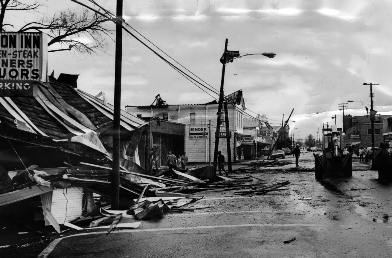
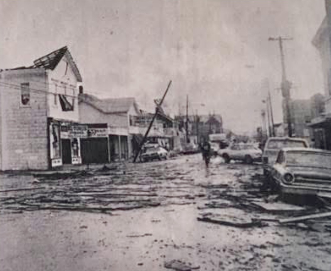
Mason’s only fire station at the time was in downtown Mason, and its roof collapsed during the tornado, trapping all the emergency vehicles and equipment in the engine room on the left side of the building. Shortly after the tornado, Mason built two fire stations to prevent this from happening again. One of the new sites is near Sherman Terrace and would likely have been damaged during the tornado.

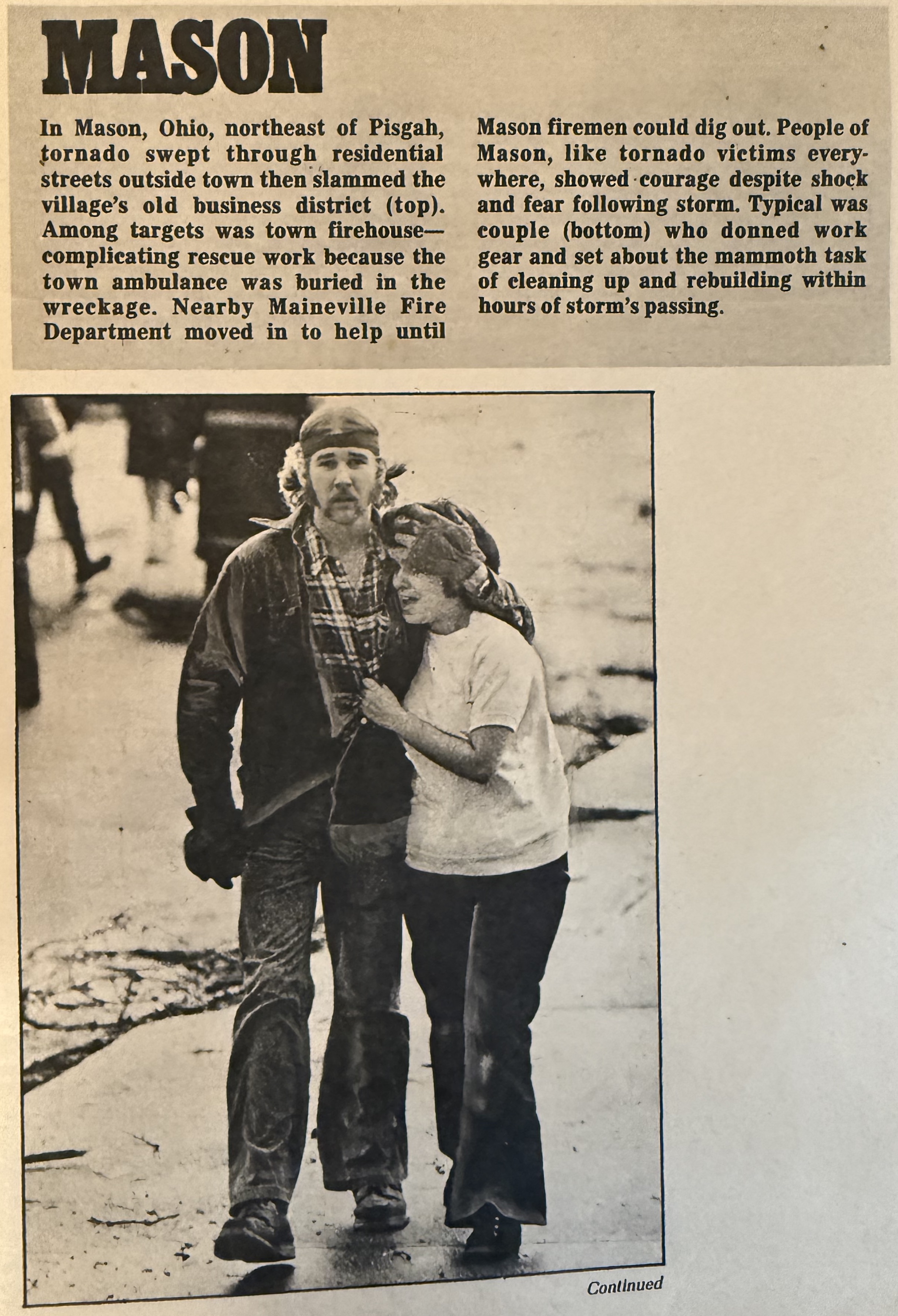
In that special issue of the Sunday magazine in the Cincinnati Enquirer, they included this gripping photograph of a couple in downtown Mason, and you can feel her fright and his shock. This always reminds me of how I felt after the tornado.
Two major structures were not damaged by the tornado, to the relief of many. The first is the water tower just 800 feet (240 m) north of the intersection of Western Row Road and Snider Road. The second is the massive 747-foot-tall (227 m) WLW radio transmission tower at the intersection of Tylersville Road and U.S. Route 42, less than half a mile (700 m) west of the Thriftway. Both are still standing today.
The tornado continued northward, ending along State Route 741, just south of its intersection with Ohio State Route 63, west of Lebanon, Ohio. I have not found any photographs of damage north of downtown Mason, and this area was nearly all farmland at the time.
I have read conflicting reports about fatalities and injuries from the Mason tornado. Some sources report 2 deaths in a trailer park, but the National Center for Environmental Information reports no deaths and 48 injuries.
My recollection of the tornado
Memory can be deceptive. I was 11 at the time, and my brother Mark was 12. Trying to remember what happened can get shaky, especially for things that happened fifty years ago. Still, the day was memorable, and I suspect many of the details are right.
I remember coming home from school that Wednesday afternoon. It was off-and-on stormy, and at one point the sky was an odd green. At about 4:30, the local TV station cut in with a tornado warning for Xenia, and I recall they showed a hook echo in the grainy black-and-white radar image.
Dad worked the night shift at AT&T, so he slept during the day. For some reason, he got up earlier than normal around 5:00, and we ate dinner. During dinner, the TV was tuned to WCPO (channel 9) out of Cincinnati, and shortly after 5:30, they broke into the movie being broadcast to show that they had wheeled their cameras outside and pointed them westward to see the tornado crossing the Ohio River valley. This must have been the Sayler Park tornado, which was only 9 miles (14 km) away, and the same storm cell would soon spawn the Mason tornado and later the Lebanon tornado. I was excited and said I hoped to see a tornado, having often studied the tornado page in my weather book. I think Mom or Dad said something along the lines of “hush your mouth.”
Dad got up to look southward out the small window in the front door, and he just stood there. He went to the back of the house and opened the kitchen window, then returned to the front door to keep watch. I remember from my weather book at the time that this is what you were supposed to do in a tornado, to keep the house from exploding. That is no longer the advice, but it was common wisdom then.
Either Dad or Mom told Mark and me to go to the bathroom. Our house was a single-story ranch-style on a slab, so we had no basement. The bathroom was the only interior room, and it had no windows. Mark and I didn’t think much of it, so we went in with the comics page of the newspaper. A few minutes later, Mom joined us but didn’t say anything, and Dad was still presumably looking south out the front door, towards Cincinnati, about 20 miles (30 km) away.
Dad then hurried to the bathroom. Mom sat on the toilet with the lid down, with me on her lap, and Dad and Mark were on the edge of the bathtub. Within a few seconds, there was a deafening roar. Mark says he heard the garage door get damaged, but I didn’t. I remember seeing Mark shouting, but I could not hear him over the tornado, even though he was just a few feet away. The sound didn’t last long, maybe a minute, and then it was very quiet and still.
We left the bathroom, and Mom and Dad went to the front of the house. Inside the house, there appeared to be no damage, and no windows were broken. The power was out, though, and our flip clock was frozen at 6:07; the clock on the bank downtown was similarly frozen, but at 6:10. I went to the back door and saw that the sky was again green, that there was debris all over the back yard, including our grill lying on its side. I remember looking up and seeing a rotating cloud from below. Dad later told me I couldn’t have seen that, but I remember it vividly.
We went into the front yard, and there was debris everywhere of every imaginable kind: branches, twigs, straw, paper, pebbles, and pieces of brick, lumber, and shingles. Pink fiberglass insulation flocked the trees, which had not yet leafed out for spring. The telephone poles were snapped, and power lines were down. The sanctuary of the church across the street was flattened, with bricks everywhere and a bare cement pad. Beyond that, the high-voltage power lines behind the school were crumpled, twisted, and even flattened. A vent was torn from our roof, and our garage door was damaged, probably by some flying debris or maybe just the wind.
We lived at the south end of a residential area, with the church and elementary school across the street, and farms beyond. People gradually came out of their houses and wandered the street, and I remember how worried everyone was. One panicky person told everyone to not bother cleaning up, that “more tornadoes were on their way”, and that scared me. A curfew was put in place, and the National Guard was called out to help with enforcement at the request of Sheriff Roy Wallace. Some looting was reported. The Red Cross set up a shelter for the homeless in the Mason High School, also using it as a clearinghouse for clothes, food, and supplies.
Somehow, our grandpa (Dad’s Dad) and grandma, who lived about 3 miles south of us, made it to our house. This must have been tricky with all the downed power lines. They offered to let us sleep at their house for the night, and I really wanted to go there, as they had a basement and I was just petrified. Dad said he wanted to stay at our house, but Mom went with Mark and me to our grandparents. Mom says she later regretted that (and I understand why). We laid down on their living-room floor, but I remember being awake almost all night as every breeze made me jump.
The next day, we went home and started cleanup, picking up and bagging debris. It was such a contrast from the day before, cooler, with clear blue skies. There was an endless parade of cars and sightseers, “gawkers,” Dad would angrily refer to them. It was an astounding amount of damage, and I can’t say I blame them for being curious. Federal disaster agents stopped by, and I remember Dad dismissing them, oddly annoyed and skeptical that they could help.
We were without telephone and power for several days, and we cooked on a newly purchased Coleman stove in the garage. The city was increasingly concerned about the lack of power, which prevented them from refilling the water towers. Had power not been restored, Mason would have been without water as well.
We had no school for the rest of that week. When we returned to school the following Monday, many of the kids were strongly affected by the tornadoes and were trading stories. Our English teachers had us write essays about our experiences. Even a couple years later, some students would write about the tornado in every essay, so the teachers would eventually order, “and no tornado stories!”
Tornado warnings still make my pulse jump, in a way that I don’t think the rest of my family understands. It was terrifying, and when I am stressed, I commonly have tornado dreams. I didn’t get my wish that day of seeing a tornado, and that might be part of the issue: I experienced it, but it was always unseen. I have seen tornadoes since (twice, I think), but it wasn’t as satisfying as I might have hoped!