Surfaces
Subaerial Unconformity (Sequence Boundary)
Subaerial unconformities can expressed in several different ways, depending on geomorphology and the type of rock or sediment on which they are developed. In siliciclastic systems, downcutting rivers will create incised valleys, and areas between rivers will be subject to weathering and the formation of paleosols. In areas underlain by carbonate rocks, sequence boundaries are expressed by various forms of paleokarst.
Erosion and incised valleys
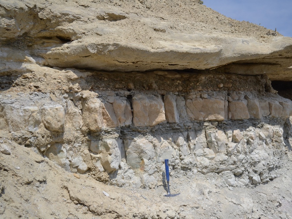
Erosion at a sequence boundary can manifest in several ways. At an individual outcrop, there may be marked truncation of meters to tens of meters of underlying strata. Such high-relief surfaces are often associated with incised valleys
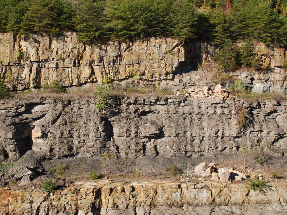
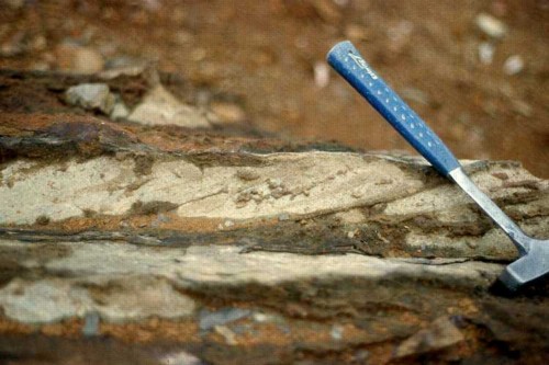
Incision at base of multi-story fluvial sandstone (brown unit at top of photo). Pennsylvanian Breathitt Group, Flat Lick, Kentucky.
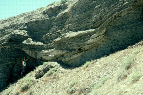
Channelled incision surface developed on offshore mudstone facies. Overlying facies are siltier and contain evidence of tidal influence. Large dolomite-cemented bodies are also associated with the channelled surface. The channel itself can be traced for at least one mile. Cretaceous Mancos Shale, Woodside, Utah.
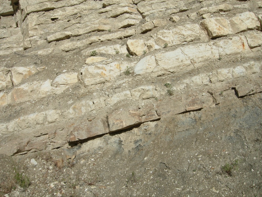
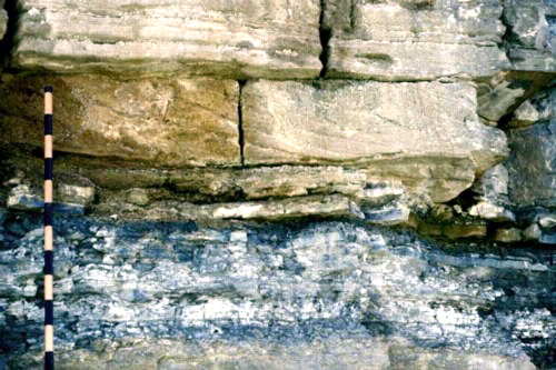
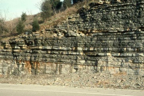
Erosion surfaces may also be more regional, with little truncation at the scale of an outcrop. Marker beds in underlying strata may be needed to detect this truncation. If there was structural tilting, erosional surfaces may display an obvious angular discordance between overlying and underlying beds.
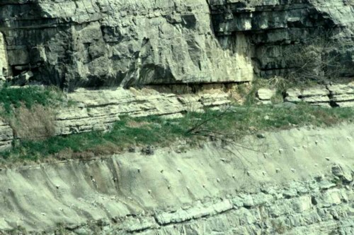
Subtle beveling on erosional surface. Mississippian Bangor Limestone, Monteagle, Tennessee.
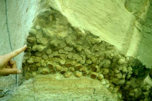
Erosion surfaces are commonly overlain by a lag, often composed of coarse siliciclastic gravel or other material not obviously derived from underlying strata.
Chert-pebble conglomerate (in shade), overlying shallow-water carbonates. The base of the conglomerate is a subaerial unconformity. Jurassic Sundance Formation, Tensleep, Wyoming.
Paleosols
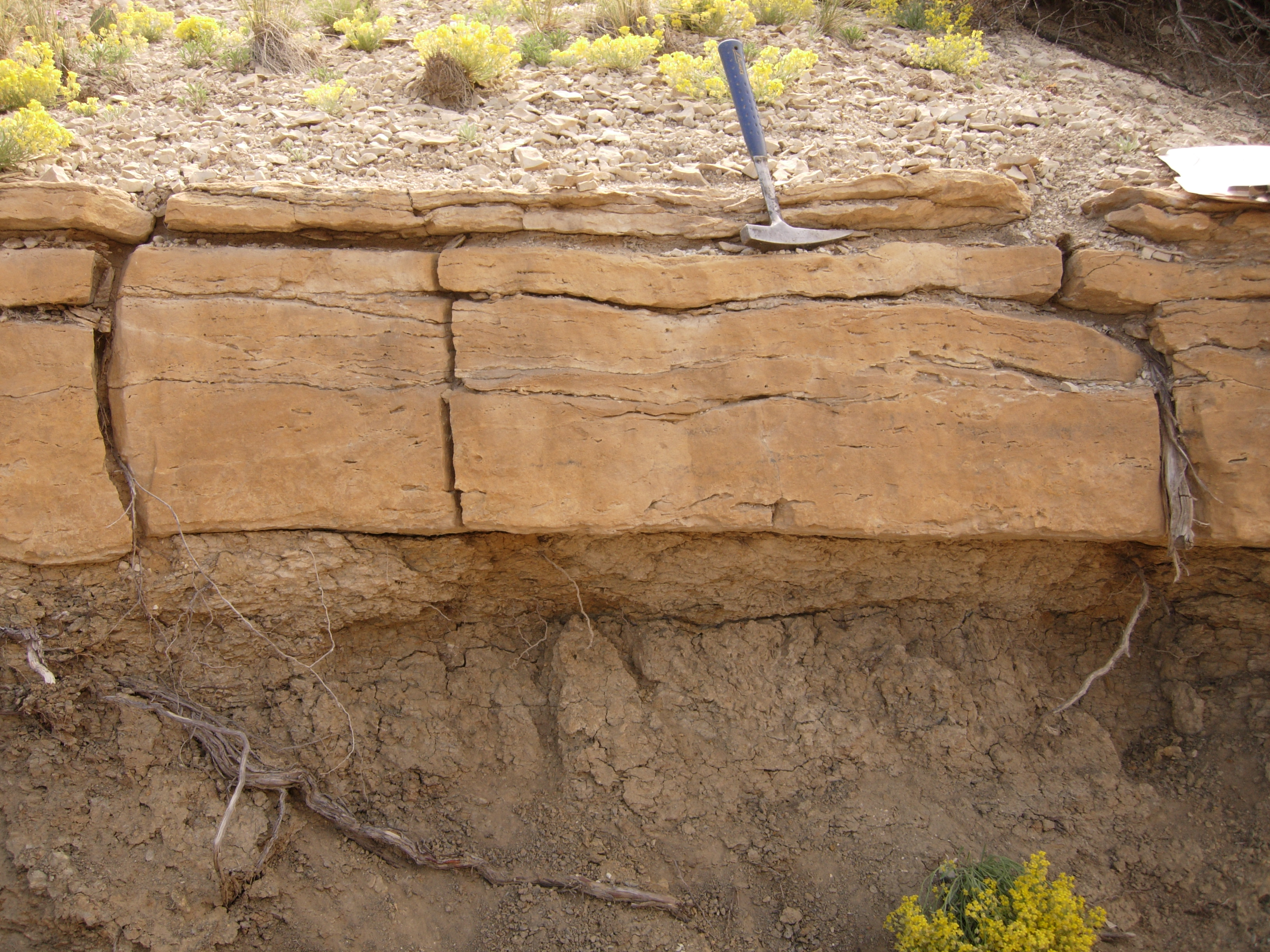
In areas undergoing subaerial weathering, paleosols form, principally on upland areas between valleys (called interfluves) and on the sides of valleys and terraces within valleys. Typically, the soil surface is perched well above the water table, causing well-drained soils to develop, fostering bleaching and anomalous deep red to brown colors.
Paleosol of bleached sandstone with strong red-brown mottling. Pennsylvanian Breathitt Group, Partridge, Kentucky.
Paleokarst
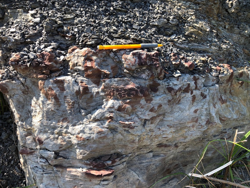
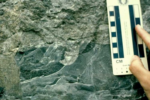
In carbonate rocks, subaerial weathering consists primarily of dissolution, causing a variety of paleokarst features to form, including caves and collapse breccias.
Limestone breccia at paleokarst surface. Knox Group, Dandridge, Tennessee..
Surface of forced regression
A wave-dominated coast has a concave-up up depositional profile that reflects an equilibrium between sediment supplied to the coast and the characteristics of the waves that strike the coast. During a relative fall in sea level, this equilibrium profile is shifted seaward and downwards, such that the equilibrium profile is above the sediment surface in the upper shoreface, but below the sediment surface in the lower shoreface and seawards. As a result, sediment accumulates in the upper shoreface when sea level falls, but erosion occurs on the lower shoreface through offshore until the sediment surface reaches the level of the equilibrium surface. Once it does, sedimentation can resume in those areas.
As a result, a surface of forced regression forms in the lower shoreface and seawards during a relative fall in sea level. Such surfaces display minor amounts of erosion, may be overlain by a lag of shells and mud rip-ups, and are typically characterized by a contact with shallower-water facies abruptly overlying deeper-water facies.
A surface of forced regression, marking the abrupt contact of underlying dark gray offshore mudstone with overlying medium-bedded shallow-marine limestone. Cretaceous Carlile Shale, Juana Lopez Member, and Fort Hays Limestone, Cañon City, Colorado.
Detail of surface of forced regression shown above, showing the numerous internal erosion surfaces in the Juana Lopez Member that immediately overlies the surface of forced regression and the underlying mudstone of the Carlile Shale. The Juana Lopez Member is bioclastic and contains abundant shark teeth. The lighter colored rocks above are the micritic limestones of the Fort Hays Limestone. Cañon City, Colorado.
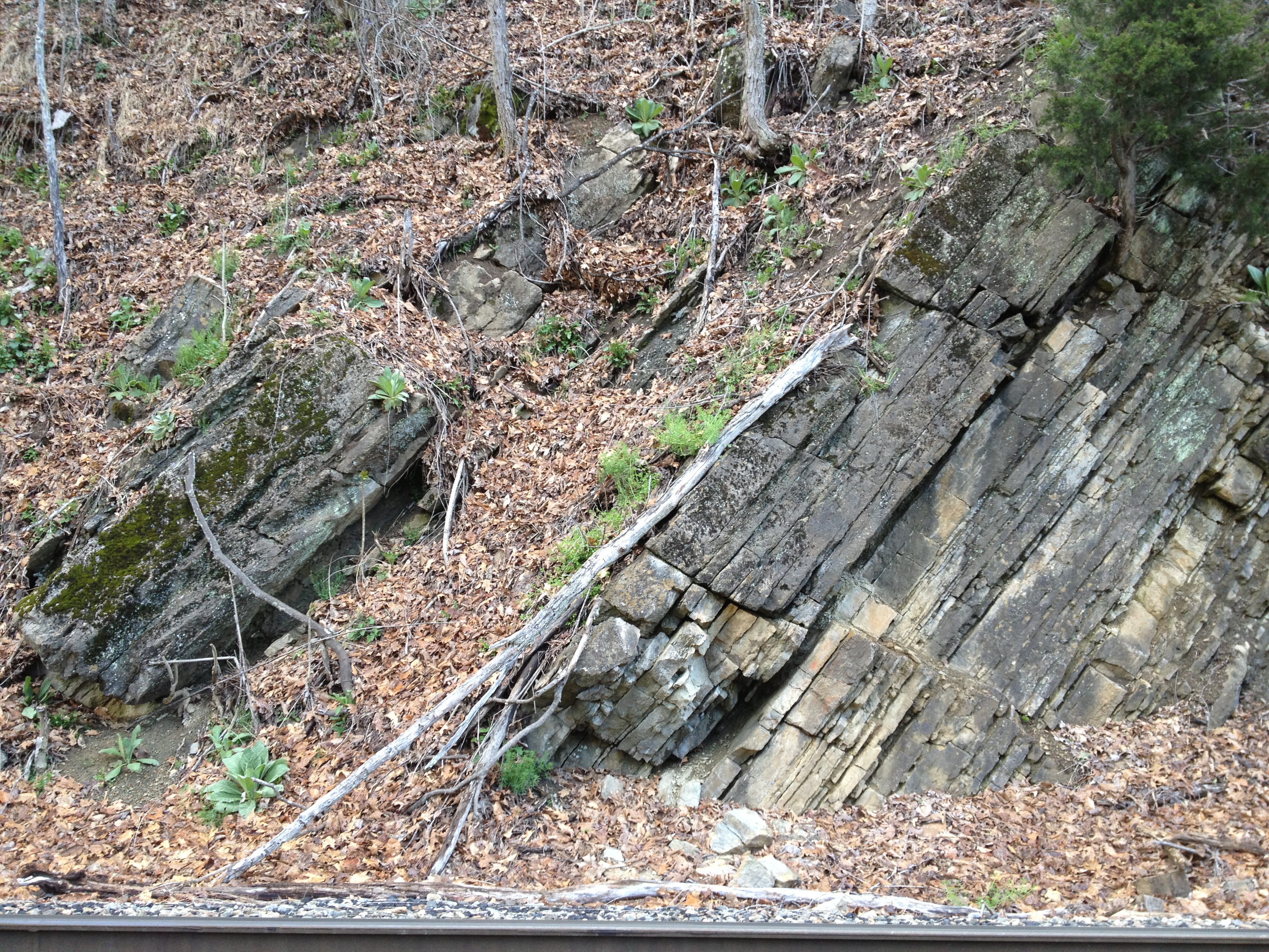
A surface of forced regression, with cross-bedded grainstone shoal facies abruptly overlying deep-subtidal storm-bedded facies. Jacob staff is marked in 10 cm increments. Upper Ordovician Hermitage Formation, Woodbury, Tennessee.
Flooding surface
Flooding surfaces are sharp contacts, with relatively deeper-water facies abruptly overlying shallow-water facies. In many cases, the overlying facies will be finer-grained than the underlying facies, but this is not always true.
Prominent flooding surface at large dead tree, with shallow-water limestone abruptly overlain by offshore shale. Note that the abrupt shift to shallow-water limestones about 2 meters higher is a surface of forced regression. Upper Ordovician Trenton and Reedsville Formations, Hagan, Virginia.
Flooding surface separating underlying red bayhead-delta facies from overlying white shoreface sandstone. This is one example of a flooding surface where the overlying facies is sandier than the underlying facies. Upper Ordovician Harding Formation, Cañon City, Colorado.
Many flooding surfaces, especially those that represent a large contrast in facies, also have evidence of prolonged slow rates of deposition, known as a condensed section. Stratigraphic condensation allows more time for slow processes normally masked by sediment accumulation to be expressed unusually well. Stratigraphic condensation can form at any flooding surface, but it is usually best developed on those within the transgressive systems tract. The maximum flooding surface is often characterized by an extensive and well-developed condensed section.
Enrichment in authigenic minerals is one common feature of condensed sections. Authigenic minerals are diagenetic minerals that precipitate within sediment, typically just below the sediment–water interface. Common authigenic minerals are glauconite, pyrite, phosphate, and siderite. Early cementation can also proceed to completion during the formation of a condensed section, turning surface sediment to rock. These hard surfaces, called hardgrounds, can be subsequently bored or encrusted by marine organisms.
Enrichment in normally rare or uncommon components of sediment is also common at condensed sections. For example, marine organisms produce shells and teeth, but these are commonly diluted by large amounts of sediment. If sediment supply is reduced, these bioclasts can accumulate without dilution, creating shell beds. Moreover, the presence of shells on the seafloor can enhance shell production because other organisms may use those shells as substrate. Similarly, volcanic ash and micrometeorites are normally minor components of sediment, but if sediment supply is cut off, these can accumulate in significant amounts. Last, clay particles scavenge uranium and thorium from the water column. If clay is allowed to sit on the sea floor for an extended period before burial, the amount of scavenged material may be large, creating a radioactive or ‘hot’ shale.
Organisms burrow marine sediment, but during times of stratigraphic condensation, this burrowing is done repeatedly on the same sediment, creating intensely burrowed horizons at some condensed sections. Compaction of sediment during condensation can change the substrate from one that is soft to one that is firm, creating what is called a firmgrounds. Firmgrounds have distinctive sets of trace fossils, called the Glossifungites ichnofacies, produced by animals capable of burrowing into compacted mud.
Iron mineralization developed along foresets and set boundaries of cross-stratified echinodermal grainstone. This mineralization is developed over a one-meter thick interval at a major flooding surface that separates underlying shallow subtidal carbonates from overlying graptolitic black shales. Upper Ordovician Fetzer Limestone, city park at Dandridge, Tennessee.
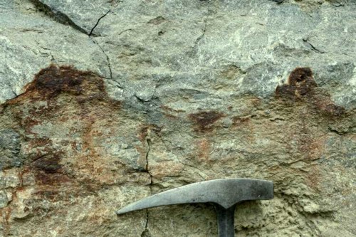
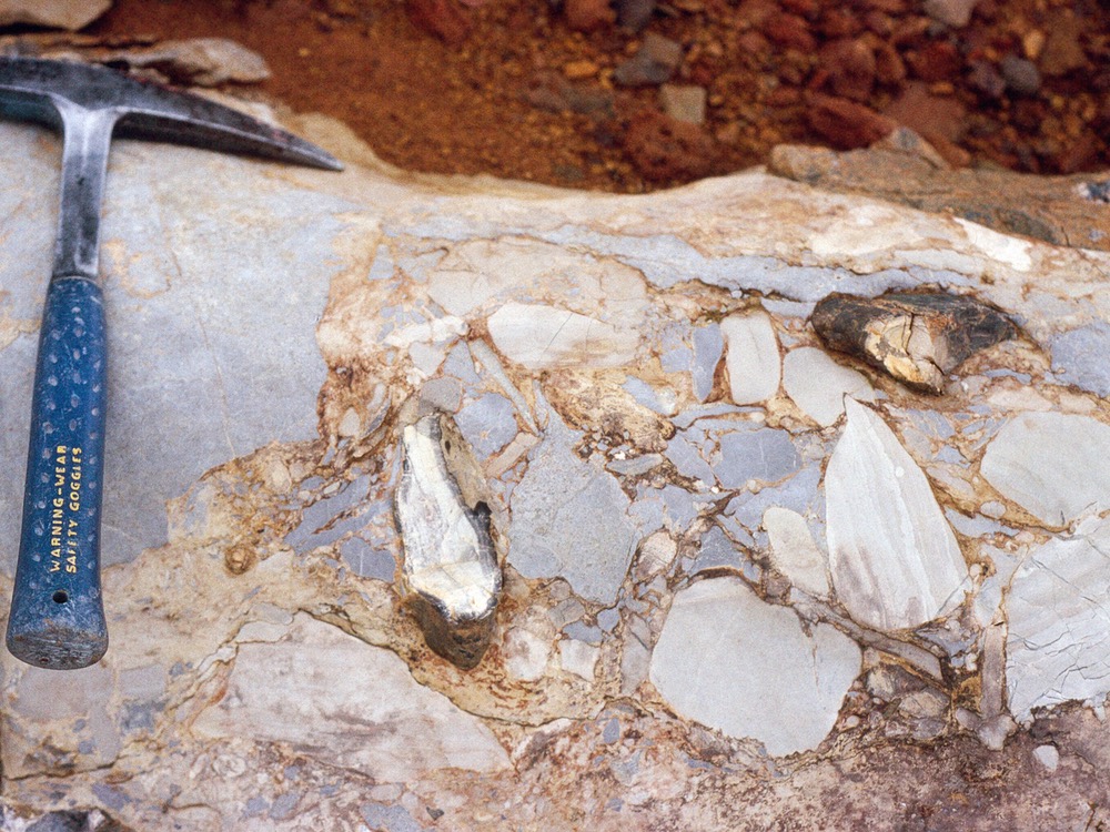
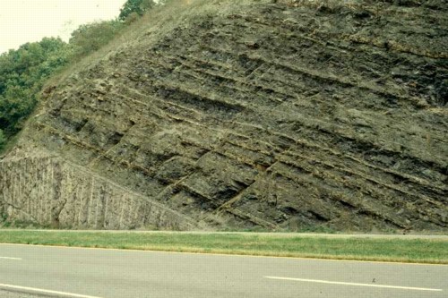
Pyritization along a hardground developed on a combined sequence boundary and transgressive surface. This hardground and possible karstic surface, with up to 10 cm of relief locally, is locally encrusted with pyrite that weathers to a rusty color. This particular horizon can be traced for tens of miles and is so distinctive that it can be identified from the highway. Upper Ordovician Leipers Limestone, Goodlettsville, Tennessee.
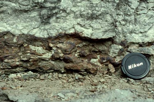
Pervasively developed pyritization along another combined sequence boundary and transgressive surface. This interval also contains phosphate coated pebbles. Upper Ordovician Leipers Limestone and Arnheim Formation, Hendersonville, Tennessee.
Pervasive phosphatization along a combined sequence boundary and transgressive surface. This surface, blackened from the phosphatization, shows evidence of several episodes of phosphatization, boring, and erosion. Upper Ordovician Arnheim Limestone, Hendersonville, Tennessee.
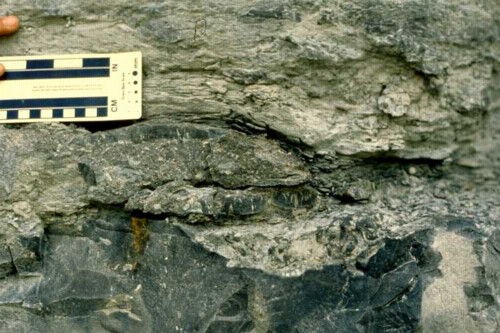
Boring developed on a phosphatized hardground. Upper Ordovician Arnheim Formation, Hendersonville, Tennessee.
Glossifungites burrows from the base of a sandstone bed. Cretaceous Blackhawk Formation, Straight Canyon, Book Cliffs, Utah.
Combinations of surfaces
Some surfaces reflect multiple, distinct sets of sedimentary processes and can therefore be difficult to interpret, at least initially. For example, it is common for subaerial unconformities to be flooded by the ocean during the transgressive systems tract, resulting in a single surface that records subaerial weathering and stratigraphic condensation. Combined sequence boundaries and transgressive surfaces are extremely common in cratonic basins and the updip, slowly subsiding portions of passive margins and distal foreland basins.
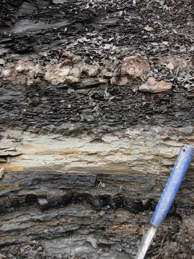
A prominent transgressive surface that is also a subaerial unconformity (sequence boundary) sequence boundary. This surface separates underlying light-colored shallow-subtidal carbonate from overlying darker deep-subtidal carbonate and mudstone. Note the pyritization, visible as a rusty stain, at this surface. This surface has meters of erosional truncation regionally, as well as meteoric cements, and a light carbon isotope spike indicative of a soil. Upper Ordovician Carters Limestone and Hermitage Formation, airport at Nashville, Tennessee. This outcrop has subsequently been removed and is no longer visible.
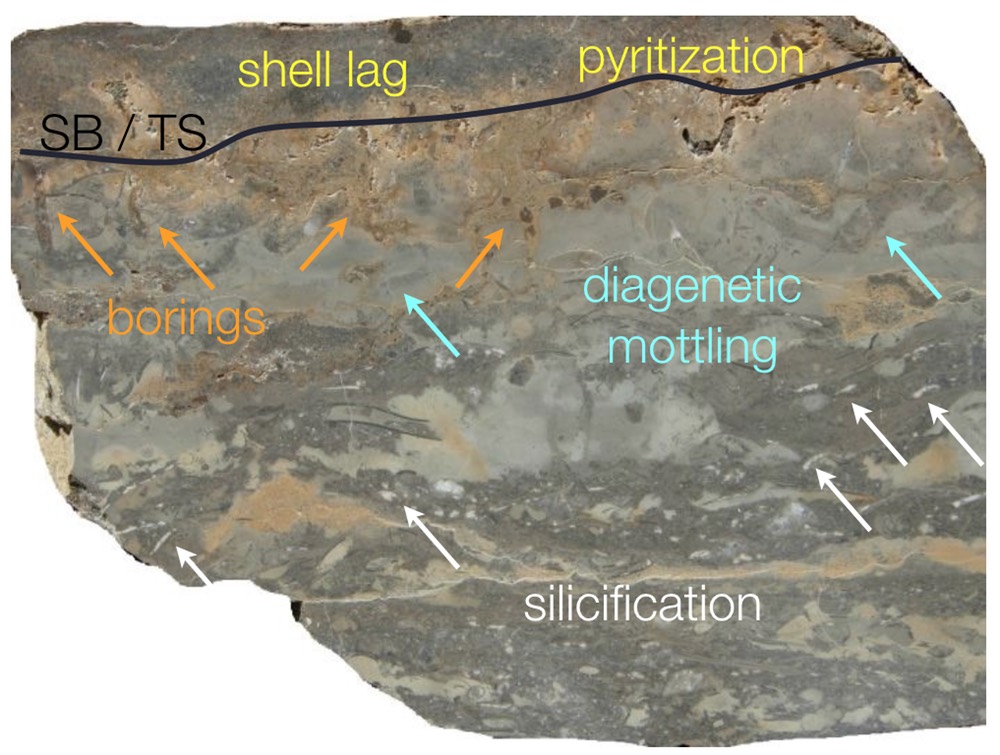
Polished slab of the combined sequence boundary and transgressive surface shown above. This 15-cm high slab has features related to subaerial exposure, including silicification, diagenetic mottling, meteoric cements, and a light carbon isotope spike, as well as feature related to stratigraphic condensation, including a shell lag, phosphatization, and borings. Upper Ordovician Carters Limestone and Hermitage Formation, Woodbury, Tennessee
A combined sequence boundary and transgressive surface (top of light-colored horizon) in a deltaic setting. Bleaching occurred during subaerial exposure, followed by boring and precipitation of siderite both in the burrows and in the knobby layer about 15 cm above the sequence boundary. Pennsylvanian Breathitt Group, Flat Lick, Kentucky.
A prominent transgressive surface separates underlying shallow subtidal carbonate from overlying offshore mudstone. Nolichucky Formation, southwest Virginia.
